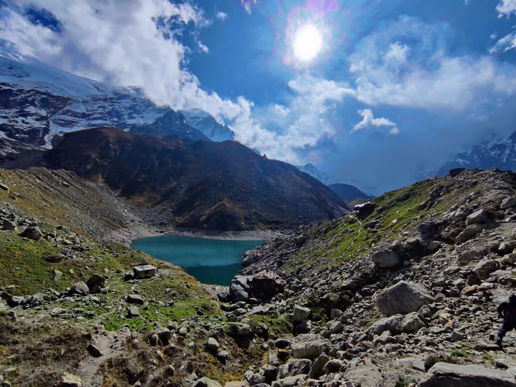
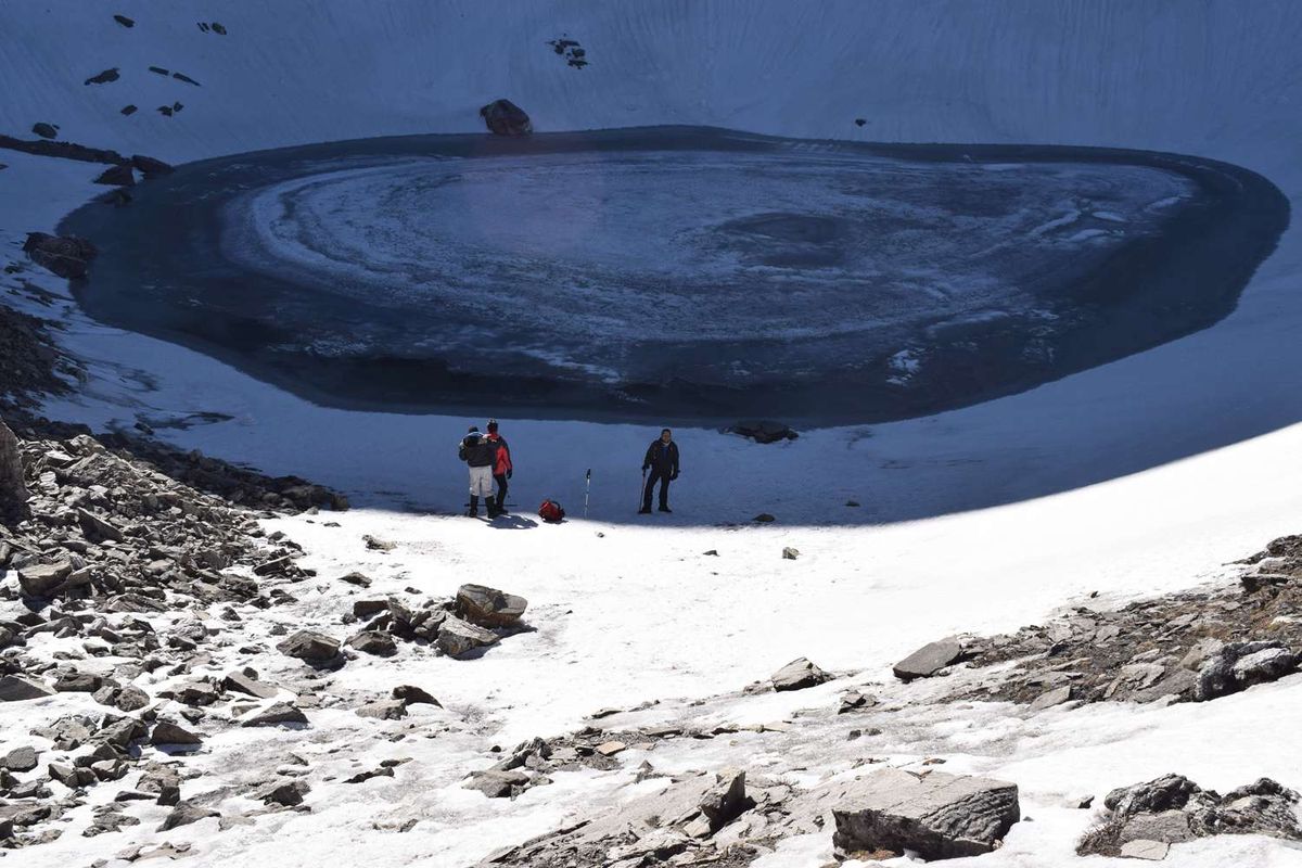
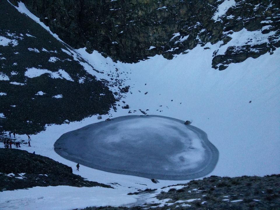
Roopkund Trek has something that almost no other trekking destination in the world has — a genuine mystery. The glacial lake at 5,029 metres is surrounded by hundreds of human skeletons, preserved by the cold for over a thousand years. A forest ranger first found them in 1942. DNA analysis conducted decades later identified the remains as belonging to 9th-century pilgrims, most likely killed by a sudden catastrophic hailstorm at altitude. The bones are still there every time the snow melts.
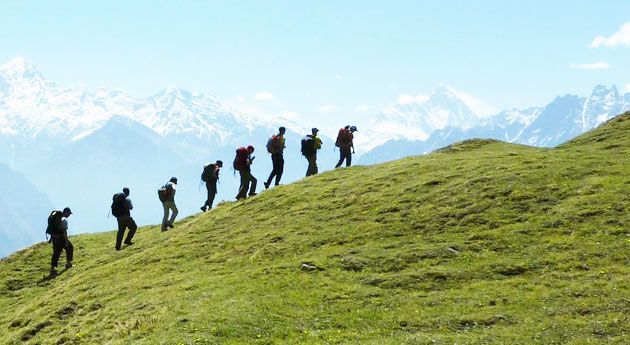
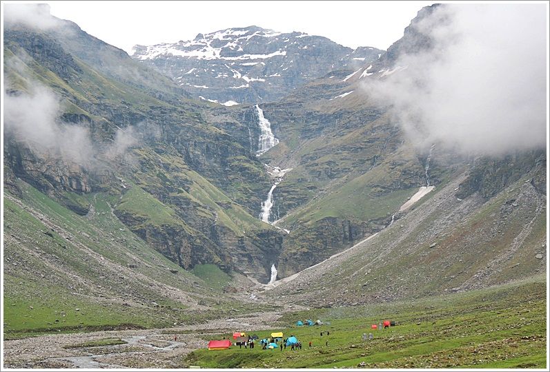
That history adds a layer to this trek that no marketing can manufacture. But step back from the lake itself and the route stands completely on its own. The approach from Lohajung takes you through Ali Bugyal and Bedni Bugyal — high-altitude grasslands at 11,000 to 12,000 feet that roll across open ridges with Trishul and Nanda Ghunti filling the skyline. Camping in these meadows overnight, watching those peaks hold the last light of the day, is the kind of experience people describe in terms of before and after.
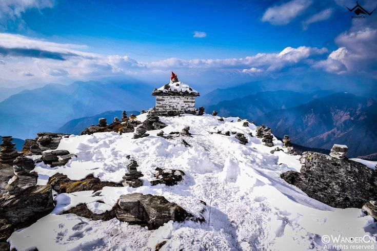
The final push crosses the Junar Gali ridge at nearly 16,000 feet before descending to the lake. The whole route — forest, meadow, high ridge, glacial lake with its millennium-old human remains — is one of the most complete mountain journeys in Uttarakhand. The distance, the altitude gain, the variety of terrain, and the strangeness of the destination all add up to something that stays with you.
Roopkund Trek at a Glance
| Detail | Info |
|---|---|
| Total Distance | 53 km |
| Maximum Altitude | 15,750 ft (Roopkund / Junargali) |
| Bugyal Altitude | 11,000–12,000 ft |
| High Camp Altitude | 14,000 ft |
| Daily Walking Time | 5–8 hours |
| Experience Required | At least one prior moderate Himalayan trek |
| Base Camp | Lohajung (7,870 ft) |
| Nearest Railway Station | Kathgodam (~180 km) |
Why This Roopkund Trek Is Different
The Bugyals
Ali Bugyal and Bedni Bugyal are among the finest high-altitude meadows in Uttarakhand — possibly in the entire Indian Himalaya. At 11,000 to 12,000 feet, they stretch across broad open ridges with no trees, no structures, and the peaks right there on the horizon. The scale is disorienting in the best way. Walking across them in the morning light, with Trishul ahead and nothing between you and the sky, is the kind of thing that justifies the entire trip before you even reach the lake.
Bedni Kund
Within Bedni Bugyal, Bedni Kund is a small sacred lake with a temple beside it. At 11,900 feet, with Trishul directly behind the structure, it is one of those compositions that photographers return to Roopkund specifically to capture. The simplicity of it — stone temple, still water, enormous mountain — is exactly right.
The Junar Gali Ridge
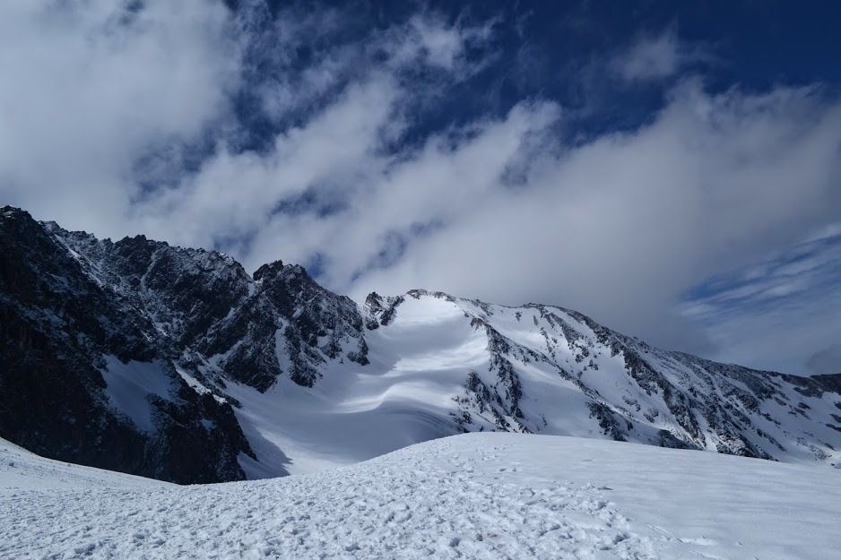
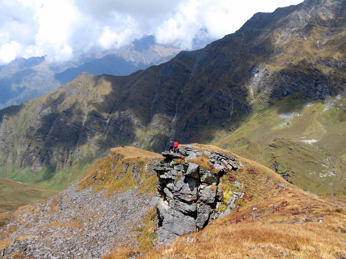
The crossing of Junar Gali at 15,700 feet is the physical and psychological high point of the trek. The ridge is exposed and steep, and the view from it — with Roopkund visible below on one side and the bugyals stretching back on the other — is a complete picture of everything the trek has been building toward.
The Lake Itself
Roopkund at 15,750 feet is partially frozen for most of the season. The bones are visible around the shore and sometimes in the shallows of the meltwater. The Archaeological Survey of India has studied and documented the site extensively. Do not touch the bones. Sit near the lake, look around at the ice walls and the impossibly blue sky, and think about the group of people who were here over a thousand years ago and never made it back down.
Why This Roopkund Trek Is Different
The Bugyals
Ali Bugyal and Bedni Bugyal are among the finest high-altitude meadows in Uttarakhand — possibly in the entire Indian Himalaya. At 11,000 to 12,000 feet, they stretch across broad open ridges with no trees, no structures, and the peaks right there on the horizon. The scale is disorienting in the best way. Walking across them in the morning light, with Trishul ahead and nothing between you and the sky, is the kind of thing that justifies the entire trip before you even reach the lake.
Bedni Kund
Within Bedni Bugyal, Bedni Kund is a small sacred lake with a temple beside it. At 11,900 feet, with Trishul directly behind the structure, it is one of those compositions that photographers return to Roopkund specifically to capture. The simplicity of it — stone temple, still water, enormous mountain — is exactly right.
The Junar Gali Ridge
The crossing of Junar Gali at 15,700 feet is the physical and psychological high point of the trek. The ridge is exposed and steep, and the view from it — with Roopkund visible below on one side and the bugyals stretching back on the other — is a complete picture of everything the trek has been building toward.
The Lake Itself
Roopkund at 15,750 feet is partially frozen for most of the season. The bones are visible around the shore and sometimes in the shallows of the meltwater. The Archaeological Survey of India has studied and documented the site extensively. Do not touch the bones. Sit near the lake, look around at the ice walls and the impossibly blue sky, and think about the group of people who were here over a thousand years ago and never made it back down.
How to Reach Lohajung
By Train and Road
Kathgodam is the nearest railhead — well connected from Delhi. From Kathgodam, buses and shared cabs run to Lohajung via Almora, Kausani, Gwaldam, and Tharali. The journey takes 8 to 9 hours. From Rishikesh, the route goes via Pauri and Tharali — around 220 km.
By Road from Delhi
Delhi to Kathgodam (approximately 300 km), then the mountain road to Lohajung. Full day journey.
What to Carry
Sleeping bag rated to -15°C for high camp. Crampons and trekking poles — snow is almost always present at Roopkund and on the Junar Gali crossing. Layered clothing including a quality windproof and waterproof outer shell. Sunglasses and sunscreen for snow glare. Emergency medication for altitude sickness — consult your doctor before the trek.
What to Expect on the Ground
Forest permits are standard and arranged by most operators. The bones at Roopkund are protected under Archaeological Survey regulations — they must not be touched or disturbed in any way. High camp at 14,000 feet can reach -15°C at night. A quality operator will have Diamox available and a clear protocol for altitude-related emergencies.