
Duration: 8 Days
Maximum Altitude: 15,750 ft (Roopkund / Junargali)
Bugyal Altitude: 11,000–12,000 ft
High Camp Altitude: ~14,000 ft
Difficulty: Difficult
Best Season: May to June, September to October
Base Camp: Lohajung
Starting Point: Kathgodam / Rishikesh
The Short Version
An 8-day difficult trek through the finest high-altitude meadows (bugyals) in Uttarakhand, ending at a glacial lake at 15,750 feet surrounded by ancient human skeletons. The bones belong to 9th-century pilgrims killed in a catastrophic hailstorm. DNA analysis confirmed it. They are still there. The route covers 53 km across varied terrain including forest, meadow, high ridge, and glacial lake. One of the most complete mountain journeys in the region.
The Longer Story
Roopkund is unique on this list because it offers something that no amount of scenic beauty or altitude record can manufacture: genuine mystery.
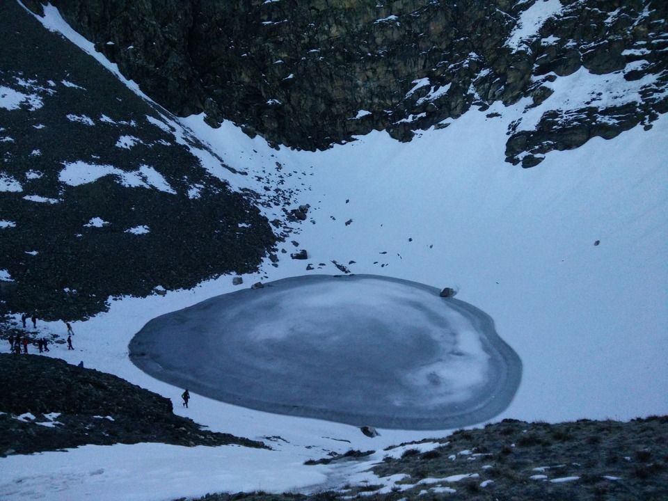
A forest ranger discovered the skeletons in 1942. The lake at 5,029 metres, surrounded by hundreds of bones, came to national attention and then international attention as archaeological researchers attempted to understand who these people were and how they died. DNA analysis conducted in the 2000s identified the remains as belonging to 9th-century pilgrims — men and women — and pointed to a sudden, catastrophic hailstorm as the cause of death. The stones that killed them, analysis suggested, were the size of cricket balls and fell from directly above with lethal force. There was no shelter. Nobody survived.
The bones are still there. Every time the snow melts at Roopkund Trek, they reappear — around the shore, in the shallows of the melt-water, on the surrounding rocks. The Archaeological Survey of India has studied and documented them. They are protected and must not be touched. But they are visible, real, and entirely disorienting in a landscape that would otherwise be merely extraordinary.
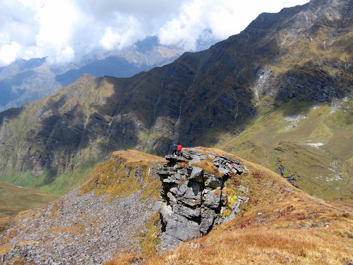
And the landscape is extraordinary, entirely apart from the lake. The route from Lohajung through Ali Bugyal and Bedni Bugyal is considered by many experienced Himalayan trekkers to be the finest bugyal trekking in India. At 11,000 to 12,000 feet, these open grasslands roll across broad ridges with Trishul and Nanda Ghunti on the horizon and nothing between you and the sky in any direction. The scale is disorienting in the best possible way.
Bedni Kund, within Bedni Bugyal, is a sacred lake at 11,900 feet with a stone temple beside it and Trishul rising directly behind the structure. It is one of the most quietly perfect compositions in the Himalaya — still water, ancient temple, enormous peak — and photographers plan entire trips around it.
The Junar Gali ridge crossing at 15,700 feet is the physical and emotional high point of the trek before the lake itself. From the ridge, Roopkund is visible below on one side and the full sweep of bugyals stretches behind you on the other. For a moment, the entire route is visible at once.
The Itinerary at a Glance
| Day | Route | Type | Hours |
|---|---|---|---|
| Day 1 | Kathgodam / Rishikesh to Lohajung | Drive | 8–9 hrs |
| Day 2 | Lohajung to Didna Village | Trek | 5–6 hrs |
| Day 3 | Didna to Ali Bugyal | Trek | 5–6 hrs |
| Day 4 | Ali Bugyal to Bedni Bugyal to Pathar Nachauni | Trek | 4–5 hrs |
| Day 5 | Pathar Nachauni to Bhaguvasa High Camp | Trek | 3–4 hrs |
| Day 6 | Bhaguvasa to Roopkund and Back | Trek | 9–10 hrs |
| Day 7 | Descent via Bedni Bugyal to Wan Village | Trek | 6–7 hrs |
| Day 8 | Wan to Lohajung, Drive Back | Drive | Full day |
Places to Visit During the Roopkund Trek
The Roopkund Trek is not only known for its mysterious glacial lake and ancient skeletons. The route from Lohajung to Roopkund passes through some of the most beautiful high-altitude landscapes in Uttarakhand, including dense forests, vast alpine meadows, sacred lakes, mountain ridges, and remote campsites. According to your uploaded guide, the trail covers around 53 km and includes several major highlights along the route.
1. Lohajung
Lohajung is the traditional base village for the Roopkund Trek. Surrounded by forested mountains, it is where trekkers usually begin their journey toward the high-altitude meadows and Roopkund Lake. The village provides an opportunity to experience the peaceful atmosphere of rural Uttarakhand before entering the more remote sections of the Himalayas.
2. Didna Village
Didna is one of the traditional Himalayan villages encountered on the Roopkund route. The village provides a glimpse into local mountain life, with traditional houses, terraced landscapes, and views of the surrounding hills.
The trail around this section gradually moves away from the settled areas and toward the forests and alpine landscapes higher up the mountain.
3. Ali Bugyal
Ali Bugyal is one of the major highlights of the Roopkund Trek and is considered one of the finest high-altitude meadow landscapes in Uttarakhand. Located at around 11,000–12,000 ft, the vast grassland stretches across the mountain ridge with enormous open views of the surrounding Himalayas.
The landscape changes dramatically here. Dense forests give way to wide-open meadows where there is little between you and the sky. On clear days, trekkers can see Trishul and Nanda Ghunti dominating the horizon.
Ali Bugyal is particularly beautiful during the summer when the meadows turn green and wildflowers begin appearing across the landscape.
4. Bedni Bugyal
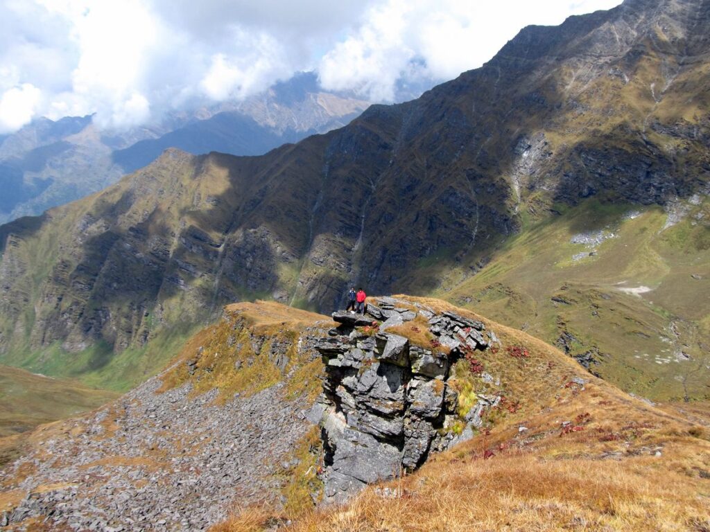
Bedni Bugyal is arguably one of the most spectacular places on the Roopkund route. This enormous alpine meadow sits at approximately 11,000–12,000 ft and provides expansive views of the Himalayan range.
The combination of green meadows, distant snow-covered peaks, and open skies makes Bedni Bugyal an exceptional location for photography and camping. The landscape is especially impressive during sunrise and sunset when the surrounding mountains change color.
5. Bedni Kund
Located within Bedni Bugyal, Bedni Kund is a small sacred lake surrounded by the high Himalayan landscape. A traditional stone temple stands beside the lake, while Trishul rises dramatically in the background.
The combination of the quiet water, ancient temple, open meadow, and towering mountain creates one of the most memorable views on the entire trek. It is also an important cultural point along the route.
6. Pathar Nachauni
Pathar Nachauni is a high-altitude campsite located along the route toward Roopkund. The landscape becomes increasingly rugged as trekkers move away from the broad lower meadows toward the high mountain terrain.
The campsite is surrounded by open slopes and provides excellent views of the surrounding ridges. It also acts as an important stopping point before moving toward the higher camps and the Roopkund section.
7. Bhaguvasa High Camp
Bhaguvasa is one of the highest camping points on the Roopkund route, situated close to the final approach toward the lake. The landscape here is much more barren and rugged compared with the green bugyals lower down.
The high-altitude environment, rocky terrain, and surrounding snow-covered slopes give Bhaguvasa a distinctly different character. Trekkers generally use this area as a high camp before making the demanding journey toward Roopkund.
8. Junargali Ridge
The Junargali Ridge is one of the highest and most dramatic points of the Roopkund Trek, reaching approximately 15,700 ft. The ridge provides an extraordinary perspective of the surrounding landscape.
From this high point, the Roopkund area can be seen below, while the enormous alpine meadows and mountain ridges stretch into the distance behind you. The crossing represents both a physical and visual high point of the trek.
9. Roopkund Lake
The ultimate destination of the trek is Roopkund Lake, situated at approximately 15,750 ft. The small glacial lake is surrounded by rugged mountains and is famous worldwide because of the human skeletal remains discovered around its shores.
The mystery surrounding the remains has made Roopkund one of the most unusual trekking destinations in the Himalayas. Research has connected the remains to people who died centuries ago, with evidence suggesting a catastrophic hailstorm. The bones become visible around the lake when the snow melts. They are protected and should never be touched or disturbed.
10. Wan Village
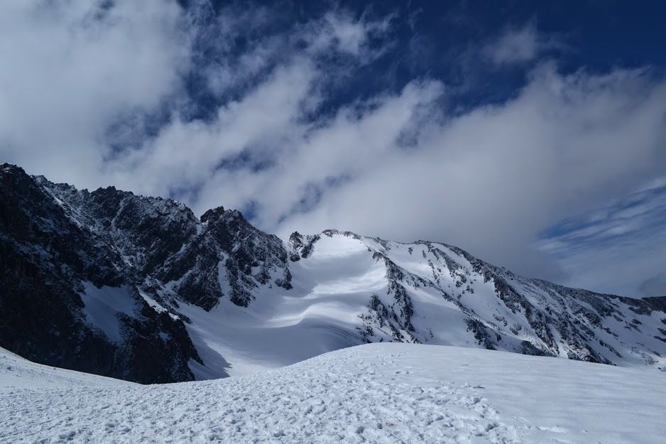
The return route can take trekkers toward Wan Village, providing a different landscape from the approach through Lohajung. Wan is an important settlement in the region and marks the end of the high-altitude section before returning toward the road network.
Who Should Do This Trek
Trekkers with at least one prior moderate Himalayan trek, comfortable with sustained effort at altitude over multiple days. Those interested in archaeology, mountain history, and the unusual alongside the scenic. Photographers specifically — the bugyals and Bedni Kund produce some of the most consistently exceptional images of any trek in India.
One Thing Most People Do Not Know
The exit route via Wan village is different from the approach trail through Lohajung. This means you are not just retracing your steps — you are completing a genuine circuit, which makes the descent feel purposeful rather than like repetition. Most quality operators include this alternate exit as standard.