Satopanth Lake Trek — Where the Alaknanda Begins and the Crowds End

  • 7 Days
  • Ask for Refund
  • Adult

  • Child

  • Infant

From 50.00 Per Adult
From 45.00 Per Child
From 40.00 Per Infant

Description

Satopanth is not a trek you plan casually. It sits at 4,540 metres in a near-vertical glacial cirque above the Mana valley, fed by three separate glaciers, and the route to get there crosses terrain that has not been softened or made convenient for tourist traffic. This is a hard trek to a remote lake, and it asks something real of the people who attempt it.

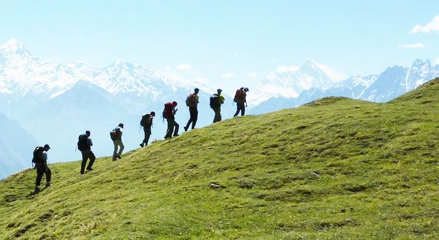
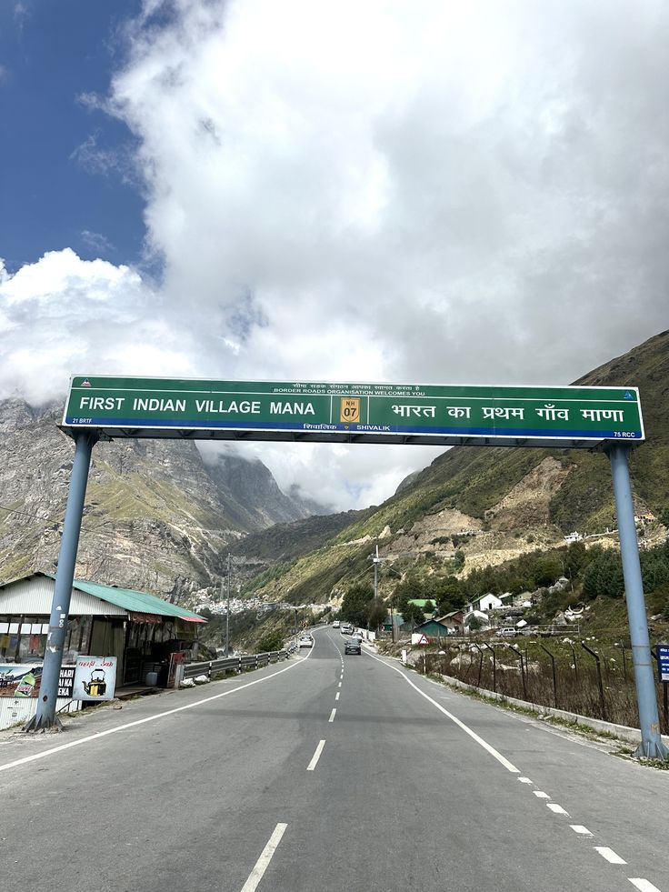
Mana village — the last Indian settlement before the Tibet border, just 3 km past Badrinath — is the starting point. Walking out of Mana in the early morning, past the Vyas Gufa cave and the Bhim Pul stone bridge, you quickly feel the difference from the Badrinath pilgrim circuit. The paths here are older, the valley wilder, and the only people heading in the same direction as you are trekkers and a small number of devoted pilgrims.

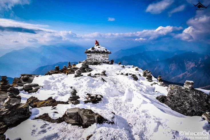
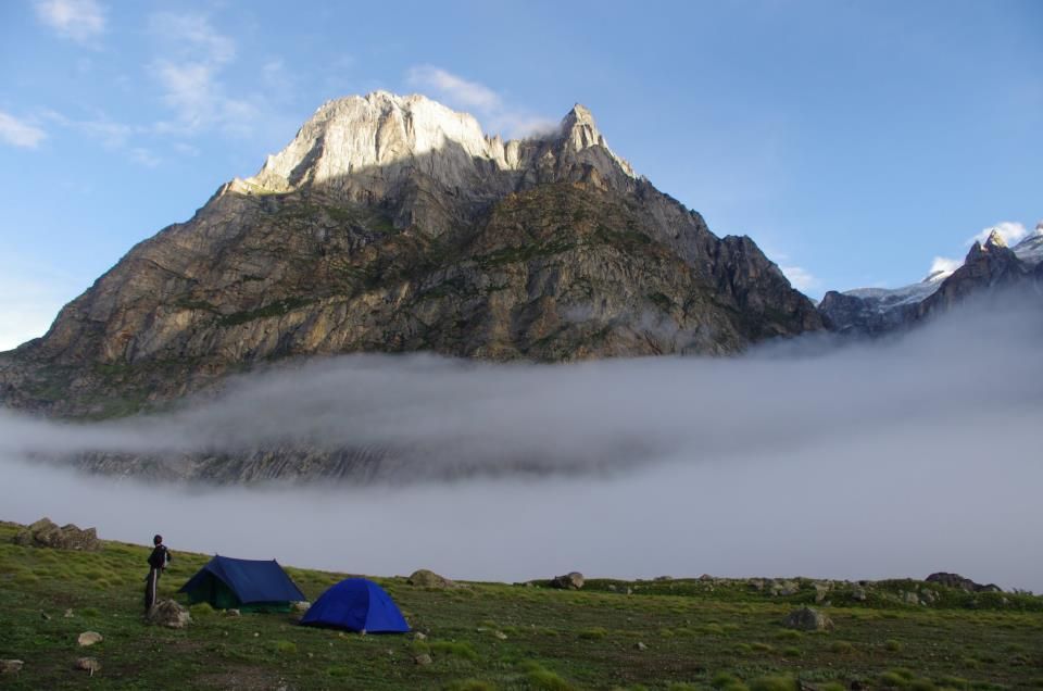
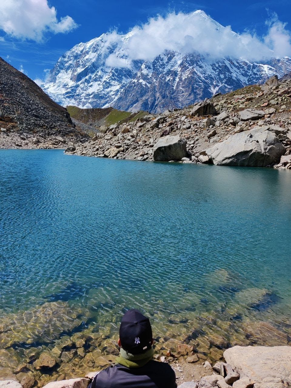
The river you are following is the Alaknanda at its very source — a fact that quietly makes itself known as you go higher and the roaring glacial stream beside you gets narrower and closer to its origin. Vasudhara Falls, at 122 metres, announces itself dramatically about halfway up. The meadows at Sukhwasa, at 13,500 feet, open onto a view of the Gangotri and Zanskar ranges that stretches the concept of “horizon.” And then the lake itself — sitting in a bowl of dark rock and ice, completely silent, with no sign of human construction anywhere in sight.

Satopanth means “the true path” in Sanskrit. The lake is considered sacred to Brahma, Vishnu, and Mahesh. The community in Mana treats it accordingly, and after you have been there, you will probably understand why.

Satopanth Lake Trek at a Glance

DetailInfo
Total Distance~38 km from Mana
Maximum Altitude14,894 ft (4,540 m)
Vasudhara Falls Altitude~12,100 ft
Sukhwasa Camp Altitude13,500 ft
Daily Walking Time5–8 hours
Experience RequiredHigh-altitude trekking experience essential
Nearest TownBadrinath (3 km from Mana)
Nearest AirportJolly Grant, Dehradun

What Makes This Satopanth Lake Trek Stand Apart

Mana Village — The Beginning Is Already Remarkable

Most treks start at anonymous trailheads. This one begins in a village that feels like the edge of the known world. Mana has the atmosphere of a place that exists slightly outside normal time — butter lamps in the evening, mani walls along the paths, the Saraswati river disappearing underground at a specific, documented point just outside the village. That underground disappearance is visible nowhere else in the country. Standing there watching the river vanish into the rock is an oddly moving experience.

Vasudhara Falls

A 122-metre waterfall falling straight down from a glacial cleft into the valley below. There is a local belief that only those of pure heart can stand beneath it without getting wet. Whether or not you test that belief, the scale of the falls at altitude — the sound, the spray, the cold mist spreading across the trail — is one of the more physically immediate experiences on any Himalayan trek.

The Sukhwasa Viewpoint

The camp at Sukhwasa, at 13,500 feet, faces one of the broadest mountain panoramas in Garhwal. The entire Gangotri range — Shivling, Bhagirathi peaks, the glaciers feeding into the Ganga — is visible from here. Spending a night at this camp before the lake push is both necessary for acclimatisation and quietly extraordinary in its own right.

The Lake Itself

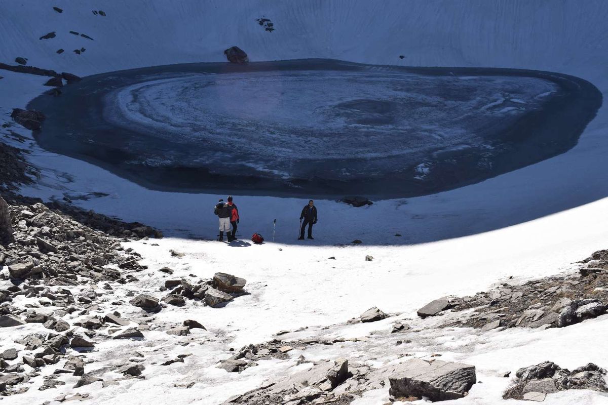
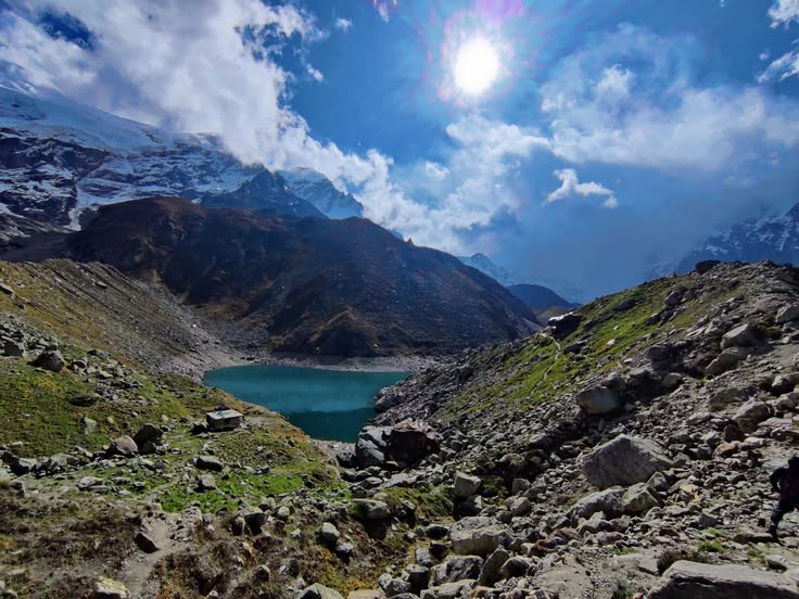
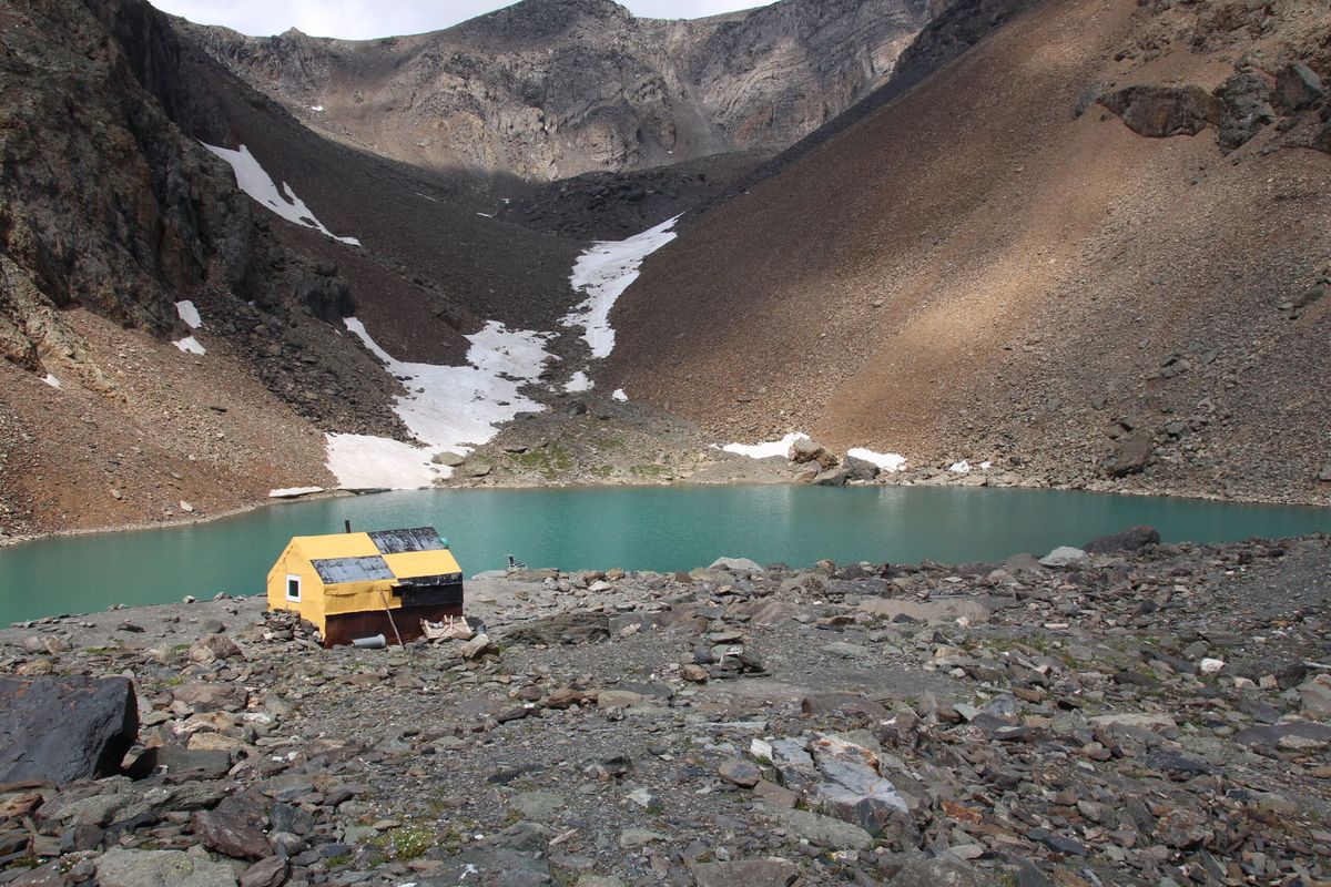
When the Satopanth basin finally comes into view after the hard moraine climb, the effect is something close to relief as much as awe. The lake is contained in a near-vertical rock and ice cirque. The water is the colour of deep shadow. There are no trails, no signs, no infrastructure. Just the lake, the ice walls, and the silence.

How to Reach Mana Village

By Train and Road

Rishikesh or Haridwar to Badrinath via the Alaknanda highway — approximately 300 km, 10 to 12 hours. During the Char Dham season (May to November), direct buses run from Rishikesh to Badrinath. From Badrinath, Mana is 3 km by foot or short taxi.

By Air

Jolly Grant Airport, Dehradun. One full day’s drive to Badrinath. Consider overnighting in Joshimath en route.

Important Practical Notes

Multiple days above 13,000 feet means altitude sickness is a genuine risk, not a theoretical one. This trek should not be attempted by anyone without prior high-altitude experience. Inner line registration near Mana may be required — confirm with your operator before departure. Snow can arrive in early October, and the window can close quickly. Plan with margin.


Duration

7 Days, 6 Nights

Group Size

12

Language

English, Bangla, hindi

Highlights Icon

Highlights

  • Mana Village — India's Last Before Tibet — The trek begins at a village where the ordinary world has already ended. Butter lamps in the evening, mani walls, the Saraswati river vanishing underground — Mana has an atmosphere unlike any other starting point in the Indian Himalaya.
  • Vasudhara Falls at 12,100 ft — A 122-metre waterfall dropping straight from a glacial cleft. The sound of it carries long before you see it, and the cold mist from the spray reaches the trail. One of the most viscerally impressive natural features on any Himalayan trek.
  • Sukhwasa Camp at 13,500 ft with the Gangotri Range — The campsite before the lake push faces the entire Gangotri range — Shivling, Bhagirathi peaks, and the glaciers that feed the Ganga. Spending a night here is reason enough to do the trek even if the lake were not at the end of it.
  • Satopanth Lake in a Near-Vertical Cirque — At 14,894 ft, the lake sits in a bowl of dark rock and ice fed by three glaciers. No trails, no signs, no infrastructure. The silence here is the kind that has a physical quality to it.
  • Sacred Geography at Its Most Remote — Named the "true path" in Sanskrit and sacred to Brahma, Vishnu, and Mahesh, Satopanth carries a mythological and spiritual weight that the approach through the Alaknanda's origin valley only deepens.
  • Following the Alaknanda to Its Source — The river you cross near Rishikesh at the start of the Char Dham drive begins here. Walking that origin valley, watching the river narrow from a roaring torrent to a glacial stream, gives the landscape a cumulative meaning that builds day by day.

Included

  • Accommodation — guesthouse in Joshimath and Badrinath, tents on the trail
  • All meals from Day 1 dinner to Day 7 breakfast
  • Permits, inner line registration assistance, and forest fees
  • Certified guide and support staff experienced with high-altitude terrain
  • Camping equipment — tents, sleeping bags, mats
  • Camping equipment — tents, sleeping bags, mats

Excluded

  • Personal trekking and cold-weather gear
  • Meals during road transit days
  • Mule or porter charges for personal luggage
  • Costs from emergency evacuation or early descent
  • Travel insurance (strongly recommended)
  • Anything not specifically mentioned under inclusions

Travel Itinerary

Day 1 - Rishikesh to Joshimath

Drive | 9 hours

Joshimath overnight is not optional — the altitude jump from the plains to Badrinath is too significant to skip a stopping point. Joshimath at 6,150 feet provides the acclimatisation night the body needs before going further.

Day 2 - Joshimath to Badrinath

Drive | 3–4 hours

Badrinath at 3,133 metres. Check into accommodation, visit the temple in the evening if timing allows. Walk around the town — the atmosphere here is unlike most pilgrimage sites, with the mountains pressed in close on all sides and the Alaknanda running loud below the ghats. Overnight in Badrinath or Mana.

Day 3 - Mana Village to Lakshmi Van or Chakratirtha

Trek | 9 km | 5–6 hours

The trail begins at Mana's edge. Walk past the Saraswati's underground disappearance, through Vyas Gufa (the cave where the Mahabharata is said to have been dictated), and across the Bhim Pul natural stone bridge. The terrain transitions from rocky scrub to alpine meadow as you gain altitude. Camp at Lakshmi Van or Chakratirtha.

Day 4 - Chakratirtha to Vasudhara Falls to Sukhwasa

Trek | 7 km | 5–6 hours

The falls arrive without warning on an otherwise open trail. After Vasudhara, the valley opens further and the high meadows of Sukhwasa appear. Camp at 13,500 feet with the Gangotri range visible across the valley rim — one of the finest mountain views in the entire region.

Day 5 - Sukhwasa to Satopanth Lake and Back

Trek | 10 km round trip | 7–8 hours

The hardest day. Moraine, glacial debris, and steep sections of scrambling before the lake basin appears. Sit with the lake — properly, not just for a photograph. Return to Sukhwasa by evening.

Day 6 - Sukhwasa to Mana Village

Trek | 6–7 hours

Same trail back. The landmarks are familiar but feel different in descent — Vasudhara from below, Bhim Pul from the opposite direction. Back in Mana by afternoon.

Day 7 - Badrinath to Rishikesh

Drive | 10–11 hours

The final day is a long one on the road, but after six days in the high mountains, there is something satisfying about watching the landscape slowly descend back to the world you left behind. The drive retraces the Alaknanda highway — past Mana, through Badrinath town, down through Joshimath where you stopped on Day 1, and then the long river road through Chamoli, Karnaprayag, Rudraprayag, and finally Devprayag where the Bhagirathi and Alaknanda join to form the Ganga. That confluence is worth a ten-minute stop — standing at the point where two major Himalayan rivers meet, knowing you just spent a week in the valley where one of them begins, closes the trip in a way that feels complete. From Devprayag, the road flattens and the mountains fall away behind you. Rishikesh by evening.

Maps

Frequently Asked Questions

Is Satopanth suitable for someone doing their first high-altitude trek?

No. This is a difficult trek with multiple nights above 13,000 feet and demanding terrain. Prior high-altitude experience is essential before attempting it.

Do I need special permits to enter Mana village?

Mana sits close to the border area, and an inner line permit or local registration may be required depending on current regulations. Operators typically handle this, but confirm in advance.

What is the biggest physical challenge on this trek?

The summit day to Satopanth Lake — roughly 10 km round trip over glacial moraine at altitudes above 14,000 feet — is the most demanding single day of the trek.

Is mobile network available anywhere on this trek?

Network is available in Badrinath and partially in Mana. Beyond Mana, there is no connectivity until you return.

Can this trek be combined with the Char Dham Yatra?

Yes, since both start from the Badrinath region, many trekkers combine a Badrinath darshan with the Satopanth trek for a single extended trip.

From ₹45.00

Book This Tour

Person Info

Adults
-
+
Children
-
+
Infant
-
+
Loader
Thank You

Booked Successfully

  • Details
Booking Summary

Satopanth Lake Trek — Where the Alaknanda Begins and the Crowds End

0 Adults
0 Children
0 Infant

Have a question in mind

Looking for more info? Send a question to the tour agent to find out more.

From ₹45.00

Book This Tour

Person Info

Adults
-
+
Children
-
+
Infant
-
+
Loader
Thank You

Booked Successfully

  • Details
Booking Summary

Satopanth Lake Trek — Where the Alaknanda Begins and the Crowds End

0 Adults
0 Children
0 Infant

You might also like

Uttarakhand

Your Question